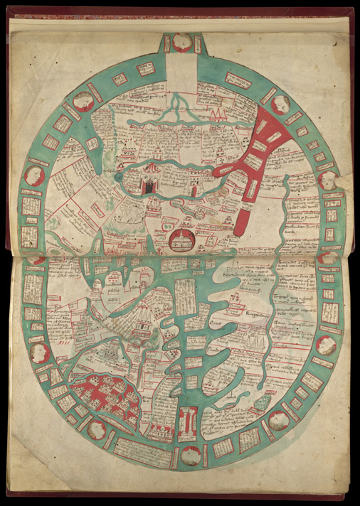
This map was probably created in Stamford, Northamptonshire in about 1350 for Ramsey Abbey in Cambridgeshire. It illustrates one of the most popular books of the later middle ages, Ranulf Higden’s encyclopaedic work, the Polychronicon.
The red semi-circle at the bottom left represents England, with Wales as a sliver below it. There is text about Ireland in the large rectangular panel at the bottom. The depiction of England includes symbols for London, Canterbury, Exeter, Bristol, Gloucester, Worcester, Nottingham, York, Durham, Lincoln, and Stamford with Cornwall named as though it were a town. The geographical relationships are broadly correct except for the north of England.